


The division develops, manufactures and integrates navigation systems for sea, land, and air applications. It is said to be developing technology that will eventually eliminate dependence on any external source for weapon or platform navigation
The 400 employees of TAMAM, the facility of Israel Aerospace Industries (IAI) responsible for developing most of the navigation systems used by the Israel Defense Forces, was founded in the 1960s. Missile technology provided by France to a joint missile project led to the decision of the late Mr. Shimon Peres to set up an independent source for navigation systems in Israel. Since then, TAMAM has been manufacturing three families of navigation systems: a mechanical gyro based system, a system based on fiber optic gyros, and a laser gyro based system.
“The goal was to establish an inertial navigation center in Israel to ensure we have our own independent navigation capabilities,” explains Ariel, head of the navigation engineering directorate at TAMAM. The facility has two lines of businesses: Electro-Optical systems, and Inertial Navigation systems. Similarly to other IAI facilities, it operates in two directorates: engineering and business. “The navigation directorate makes navigation and north-finding systems. In order to target a cannon or any other launcher that relies on the true north, one needs a dedicated system. Navigation systems help reach from one positon to another with a certain accuracy,” he adds.
TAMAM develops two types of inertial sensors: accelerometers and gyroscopes. An accelerometer measures acceleration, which is the rate of change of the velocity of an object, whereas gyroscopes are used to measure or maintain orientation and angular velocity. In the 1980s, we developed the FOG (Fiber Optic Gyroscope), which comprises a coiled optical fiber and two light beams projected in counter directions that need to reach the same point at the same time. Since the gyroscope is in constant motion, we measure the time difference between the beams to calculate the direction of the rotation. Measurements of this type are performed on three axes at the same time to determine the platform’s direction of movement. The accelerometer measures the distance passed on each axis.
“Three gyroscopes together, each one aligned with an accelerometer, make up a navigation unit called IMU, or INS if you add a GPS capability too. Some customers buy only the IMU from us and add their own navigation software and GPS. While others, such as the IDF, buy a full integrated INS/GPS system,” Ariel explains.
“The systems differ from each other in the accuracy of the measurement they provide (gyro drift). In a FOG based system, for example, our challenge is to improve the electronics and strike the right balance between the unit’s physical size and maintaining a sufficient fiber length for accuracy. The longer the fiber, the more accurate the measurement. On the other hand, there is an opposite desire - we want to reduce the physical size of the navigation system, without compromising its accuracy. The drift of the fiber-optic gyroscope is best suited for short-lived applications, such as a guided munition or a missile. The longer the operation time, the greater the drift and the accuracy decreases accordingly.”
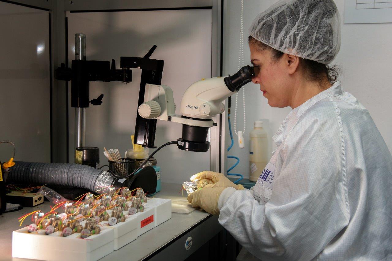
Photo: IAI
In the late 1990s, TAMAM developed a laser-based navigation system called Ring Laser Gyroscope (RLG). The physical principle behind this system is two beams are split and then directed on opposite paths through channels with ionized plasma that transforms them into laser beams. “This RLG based navigation system is far more accurate thanks to a much lower drift rate than equivalent systems. This high accuracy makes it suitable for applications with long operation time. IAI is one of just four manufacturers in the world that master this technology,” says Ariel. “Research of this type takes about a decade to complete.”
Six Ph.D. engineers at TAMAM’s navigation directorate form the professional team responsible for the development. “Every issue in any of our navigation systems is communicated to them. It is not the kind of issues you can discuss in an online forum. We also collaborate with the Technion Israel Institute of Technology and Tel Aviv University in developing future navigation technologies,” says Ariel.
Alongside the systems development, IAI provides the platform integration capability. “Customizing a navigation system to a specific platform is a unique professional niche,” explains Zalman, head of technologies and R&D at TAMAM’s navigation directorate. “Some manufacturers around the world can perform integration for either marine, ground, or air vessels. We perform integrations for all three. One of the reasons we have such complete capabilities for everything the IDF may need is that you cannot import the edge of the technology in the field. No one would sell it to you.
In the US, for example, there is a leading global manufacturer that has reached such a capability, after investing billions of dollars in R&D. TAMAM invested much less to achieve the same capabilities. The USA does not sell advanced high-end navigation systems to other countries, not even to Israel. When such a system is sold outside the USA, the sale must comply with the International Traffic in Arms Regulations (ITAR), which requires Israeli industries to declare whom they will sell the end product to and for what purposes. These restrictions limit the ability of Israeli industries to compete against other ones.
“The advantage of having a local capability is in customizing the INS performance grade to the platform. The accuracy required by a tank is not the same as that of a launcher or a mobile canon. Also pricing, is determined by the system’s accuracy (dependent on gyro drift). Tanks and cannons use the same navigation systems, but with different accuracies. Fitting a navigation system to air, marine, or ground vehicles is a specialty in itself. We make systems for everyone, including the inertial sensors, the systems and the final integration,” says Zalman.
A new investment implemented by TAMAM over the past year is in a line of mirror coating for RLG systems. RLG makes use of three mirrors, one for each axis. The manufacturing of the mirrors involves a small glass disc made locally. The disc needs to be coated. This task used to be performed abroad, but in order to enhance Israel's independence, the Ministry of Defense invested millions of NIS in a local coating line, which will be ready soon.
"We want to reach a world with GPS independent navigation capability, in any kind of mission. We are in the development stages of technology. It will take a few more years, but will eliminate our dependence on any external source for weapon or platform navigation,” concludes Ariel.